
Sections
Highlight

ISABEL MENDEZ / EUROPA PRESS
MALAGA / MADRID.
Monday, 16 January 2023, 07:47
A new winter storm, Gerard, has arrived in Spain and its passage will be strongly felt throughout the country from today (16 January). As a result, the national Met Office, Aemet, has activated weather alerts in no less than 40 provinces.
This list includes Malaga, which will have a yellow level warning for coastal phenomena in effect from eight in the morning until 11.59pm in the Axarquía and Costa del Sol areas. During that time, winds of 50 to 60 km/h are forecast and waves four metres high in coastal areas. In the city, the thermometers will register a slight decrease compared to the last few days and will move between the 9 degrees that are expected as a minimum and a maximum of 18 degrees, while the skies will remain clear although with some cloudy intervals.
In addition, on the coast of Granada there will be an amber warning from 8am to 11.59pm, with force eight westerly winds and four-metre high waves. This same area will be under a yellow warning due to winds with maximum gusts of 70 kilometres per hour from 12 noon to midnight. In Andalucía there will be cloud moving from north to south until the skies are partially or totally covered. Weak and scattered rain is not ruled out on the Atlantic slope, being more likely in the Baetic mountains and at nightfall, where snow could fall above about 1,500-1,700 metres. The temperatures will drop, with weak frosts in the interior. The winds will blow from the west, with strong gusts along the Mediterranean coast and eastern highlands.
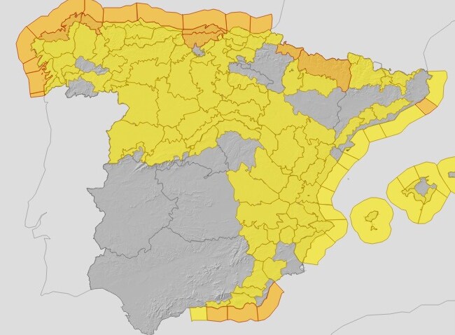
In addition to the Andalusian provinces, A Coruña and Lugo will be at significant risk (amber) this Monday due to high winds, and Teruel, Zaragoza, Asturias, Cantabria, the Balearic Islands, Albacete, Cuenca, Guadalajara, Barcelona, Tarragona, Ourense, Madrid, Murcia, Guipúzcoa, Vizcaya, La Rioja, Alicante, Castellón, Valencia, Almería, Granada, Burgos, Ávila, León, Zamora, Soria, Valladolid, Segovia, Zamora and Palencia will have yellow warnings.

Also, coastal phenomena will put Cantabria, Asturias, Girona, A Coruña, Lugo, Pontevedra, Guipúzcoa, Vizcaya, Almería and Granada at significant risk (amber). The Balearic Islands, Barcelona, Tarragona, Alicante, Castellón, Valencia and Malaga, as well as the autonomous city of Melilla, will also be at risk from high waves, but at a lower level.
Additionally this Monday the snow will affect different areas, such as Huesca, which will be at significant risk, as will Navarra, while Zaragoza, Burgos, León, Palencia, Soria, Zamora, Barcelona, Girona, Lleida and La Rioja will be on lower level alert.
The rain will also put Asturias, León, Pontevedra, Navarra, Álava, Guipúzcoa and Vizcaya at risk, while Cantabria will be at significant risk due to the same phenomenon.
All these alerts coincide with the entry of storm Gerard, which has preceded storm Fien. It will bring persistent and widespread rainfall in Galicia, the Cantabrian area and the central and western Pyrenees, which may be locally strong in the Cantabrian coastal areas and surroundings.
The rain will be less likely the further south, although in the surroundings of the Central and Iberian systems they may have a certain persistence, Aemet has forecast.
In addition, in the southern half of the peninsula, intervals of medium and high cloud are expected at first, increasing throughout the day to cloudy or covered and without ruling out some weak and occasional precipitation in mountainous areas. In the Balearic Islands and points of the central Catalan coast, an occasional shower is not ruled out and in the Canary Islands. Cloudy skies and rain are expected in the north of the islands with greater relief, and with cloudy intervals in general in the rest.
On the other hand, the snow levels will be set in the northwest of the peninsula at 1,200/1,500 metres, rising to 1,800/2,000 metres. In the rest of the northern half it will be at 700/900 metres, rising to 1,300/1,500 in the Pyrenees - where 30 centimetres could accumulate at these levels in the western Pyrenees - and 1,600/1,800 metres in the other areas.
Regarding the temperatures, the daytime temperatures will not change or will rise in the west and northwest of the peninsula, while they will drop locally notably in the southeastern third, the Balearic Islands and the surrounding Pyrenees. The minimum will increase in the northwest and decrease in the east and southeast. In addition, few changes or a slight decrease are expected in the Canary Islands, while weak frosts are expected in the north and east of the peninsula, more intense in the Pyrenees.
In addition, the wind will be from the west in the mainland and the Balearic Islands, strong in the northern and eastern thirds of the peninsula, and with very strong gusts in mountain areas, as well as in the northern plateau, the Balearic Islands and the surroundings of Alborán. Likewise, very strong intervals are forecast in the north of Galicia and trade winds in the Canary Islands.
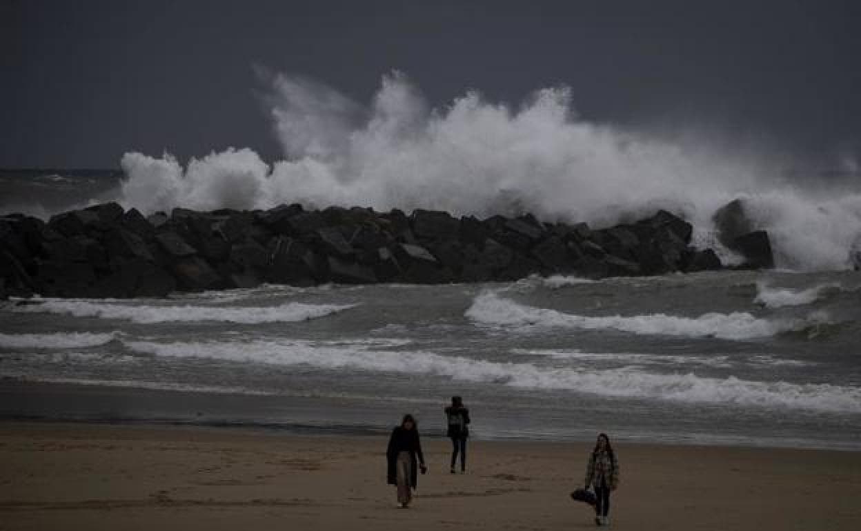
Specifically, the strong winds will give rise to a maritime storm throughout the day in the Cantabrian area, with winds that can occasionally exceed 80 km/h and waves of between six and eight metres.
After the passage of storm Gerard, the worst part of the winter storm will correspond with the arrival of Fien, the sixth of the season, which will form in the early hours of Tuesday and will be accompanied by snowfall at low levels in the centre and northern half of the country, where snowflakes could even by seen at sea level.
According to a special notice from Aemet, as of this Monday the interaction of the powerful Atlantic anticyclone centred west of the Azores, with the deepening of storm Fien, south of the British Isles, will lead to the intensification of the flow west and northwest Atlantic, making it stronger, wetter and colder.
This meteorological situation will cause a storm of winds and high waves in the peninsula and the Balearic Islands, and of snow and rain in the northern half of the peninsula, which will continue for a good part of the week.
On Tuesday, 17 January, the arrival to the northwest of the peninsula of an air mass of maritime-polar origin, very cold, is expected, which will spread in subsequent days to the rest of the mainland and the Balearic Islands, giving rise to intense winds from the northwest, and rainfall that will tend to be generalised, and that together with a pronounced thermal drop, could result in of snow at altitudes below 500 metres.
On Tuesday and Wednesday, widespread rain is expected across the mainland and the Balearic Islands, being less likely in the peninsular Mediterranean area. Again the rain could fall as snow at low levels, without being ruled out at sea level in the Cantabrian area on Wednesday. During these days the very strong gusts of wind will continue, especially on Tuesday.
On Thursday, 19 January, there could be snowfall at low levels in the northern third of the peninsula, while on Friday the 20th the entry of humid air from the northwest will continue but it is likely that it will gradually be less cold, with the consequent rise in snow level. There will be persistent rain in the extreme north of the peninsula.
Aemet has said that it is probable that on Saturday, 21 January, the Arctic air mass will be replaced by a more temperate one, thus ending this winter snap.
Publicidad
Publicidad
Publicidad
Publicidad
Esta funcionalidad es exclusiva para registrados.
Reporta un error en esta noticia

Debido a un error no hemos podido dar de alta tu suscripción.
Por favor, ponte en contacto con Atención al Cliente.

¡Bienvenido a SURINENGLISH!

Tu suscripción con Google se ha realizado correctamente, pero ya tenías otra suscripción activa en SURINENGLISH.
Déjanos tus datos y nos pondremos en contacto contigo para analizar tu caso

¡Tu suscripción con Google se ha realizado correctamente!
La compra se ha asociado al siguiente email
Comentar es una ventaja exclusiva para registrados
¿Ya eres registrado?
Inicia sesiónNecesitas ser suscriptor para poder votar.