
Sections
Highlight

María Albert
Madrid
Wednesday, 8 January 2025, 09:50
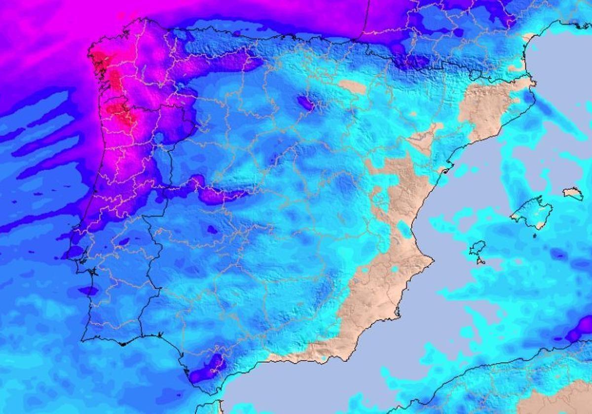
After a period of weather that soured the end of Christmas festivities in many regions of Spain, the rain is giving no respite in some areas of the country. The state weather agency Aemet has confirmed the arrival of a new weather system to the country, an Atlantic storm that will bring widespread rain to the Spanish mainland, strong wind and high waves in coastal areas from this Wednesday onwards.
Instability will once again be the main feature of these first days of the return to normality after the holiday period, with several rain fronts approaching Spain in the coming days. While the first of these is expected to approach in the coming hours, at the weekend we will have more rain and cold due to the arrival of another front from the northwest.
Las lluvias que a lo largo de la mañana caen en algunas zonas de nuestro país se deben al paso de un frente asociado a la borrasca Floriane.
— AEMET (@AEMET_Esp) January 6, 2025
→ Es la 6ª de la temporada, ha sido nombrada por @meteofrance y sus mayores efectos se notan en Francia, con vientos muy fuertes. pic.twitter.com/l721XzE9I2
In addition to all this, there will also be some frost. Although temperatures are expected to rise significantly in the coming hours, in many parts of the country we will continue to have snowfalls at medium altitudes, especially in the Pyrenees and the Cantabrian Mountains.
A new storm is approaching Spain, as confirmed by Aemet in the last few hours. A new squall will arrive this Wednesday to the Spanish mainland through Galicia and will move eastwards throughout the week, reaching the Mediterranean as it weakens.
During this period, rain is expected on the Atlantic slope , which could also move to the central area of the country. However, the most affected regions will be Galicia, west of Castilla y León and north of Extremadura, where yellow warnings could be activated due to the rainfall. We will also have light snowfalls in the Pyrenees and the Cantabrian areas, where the snow level will be above 1,600 metres during the week.
⚠️🌀 ¡Se acerca una nueva borrasca! Varios frentes dejarán 💦 lluvias abundantes, algunas tormentas y nieve. ☃️ ¿Dónde?
— Meteored | tiempo.com (@MeteoredES) January 7, 2025
👇 La previsión al detalle con @samuel_biener. https://t.co/Hcl8oqD31D pic.twitter.com/VMTlL2HXcG
At the same time, the southerly wind that will allow the arrival of this storm is expected to affect the temperatures. The thermometers over the next few days could rise suddenly from Wednesday onwards, and could be up to 10C higher than on previous days. Likewise, we will say goodbye to frost in many provinces of Spain, which will return to almost spring-like temperatures.
However, heading towards the weekend a new Atlantic front will approach Spain, according to Aemet spokesperson, Luis Bañón. Friday will be marked by abundant cloudiness and precipitation in the northwest of the mainland, where frost is not ruled out in some places. Rain is expected in Galicia, Asturias, Cantabria, the Basque Country, northern Castilla y León and the Pyrenees.
The atmosphere will be different in the rest of the country, where anticyclonic conditions are expected to prevail throughout the weekend. With instability decreasing, with the exception of some showers in the centre and east of the mainland, it is possible that the snow level will drop to 1,200 metres. Even so, there will be snow in some mountains in Galicia and Cantabria and in the Pyrenees over the next few days.
⚠️🚩 Estamos a las puertas de un nuevo temporal 🌀 y el viento será uno de los principales protagonistas. 💨 Las rachas podrán superar los 100 km/h.
— Meteored | tiempo.com (@MeteoredES) January 7, 2025
👇 La previsión con Sergio Escama. https://t.co/TvedIbdMjy pic.twitter.com/L2TqXak8Ye
Looking ahead to Sunday, and especially to next week, uncertainty increases, although everything points to stability once again prevailing over most of the country. Even so, rain is not ruled out in western Galicia, the central system and the Pyrenees, where we could have quite significant accumulations throughout the day.
Publicidad
Publicidad
Publicidad
Publicidad
Esta funcionalidad es exclusiva para registrados.
Reporta un error en esta noticia

Debido a un error no hemos podido dar de alta tu suscripción.
Por favor, ponte en contacto con Atención al Cliente.

¡Bienvenido a SURINENGLISH!

Tu suscripción con Google se ha realizado correctamente, pero ya tenías otra suscripción activa en SURINENGLISH.
Déjanos tus datos y nos pondremos en contacto contigo para analizar tu caso

¡Tu suscripción con Google se ha realizado correctamente!
La compra se ha asociado al siguiente email
Comentar es una ventaja exclusiva para registrados
¿Ya eres registrado?
Inicia sesiónNecesitas ser suscriptor para poder votar.