Hiking in Malaga
Sections
Highlight
It has been almost four years since the long-awaited declaration of national park status being granted to the Sierra de las Nieves mountain range. Before this historic moment happened, Rafael Flores was already preparing what has now become the first ever map of this protected area, which is also the first of its kind in the province of Malaga.
This week saw the release of the culmination of an arduous task carried out by someone who knows every nook and cranny and every trail in this new national park. Rafael Flores, a Ronda local, is the author of numerous publications on this and other mountainous areas of Malaga province, which he has combined in recent years with his work as a guide in his own active tourism company, RF Natura.
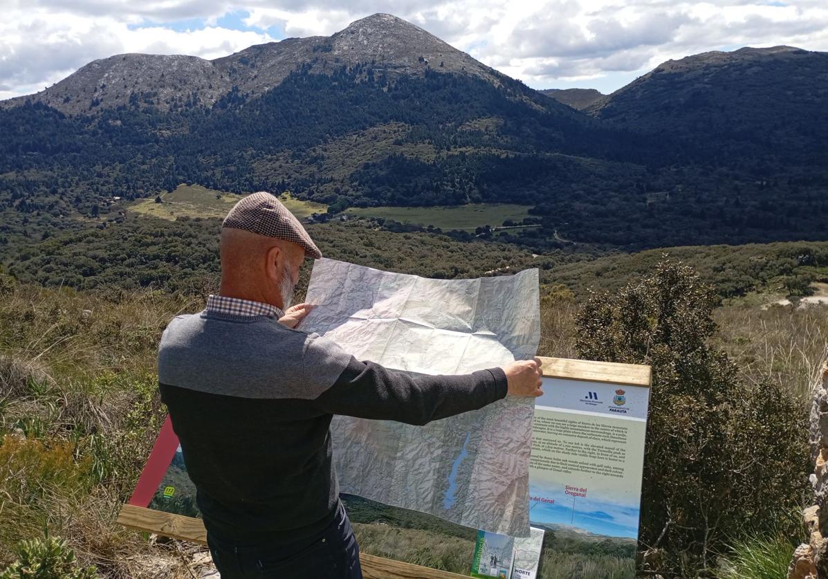
The map, produced by publishing company Piolet and La Serranía, is presented in two sheets on a scale of 1:25,000. Both maps, unfolded, each measure 68 by 99 centimetres, but can be folded and fitted into a 12 by 21 centimetre folder, which is ideal for carrying in a rucksack or even by hand in a pocket when hiking or mountaineering.
Both hiking and cycling routes in the park are represented here. That is to say, from the long-distance stages of numbered routes (GR), to local trails (SL), short routes (PR) and public footpaths. In addition, all routes can be downloaded from Piolet's Wikiloc profile.
"The map is as up to date as possible and we have not only included all the existing trails but also the new facilities that exist or are being completed, such as car parks, viewpoints or the visitor centre," says Rafael Flores.
Another important new feature of these maps is the correction of the toponymy (place names), so "the names of enclaves or their exact location have been corrected." Also the types of trail needed reclassifying: "There are cases in which there were some lanes that appeared as footpaths and vice versa," explains Rafael Flores, adding that many paths have now been included that were not included in the IGN map (Spain's national geographic institute).
The first official map of the Sierra de las Nieves national park focuses especially on the most attractive area such as the massifs around Tolox, Yunquera or Parauta, but it also covers the whole area of this biosphere reserve and even the Blanca and Canucha mountain ranges.
Such a map continues to be an essential tool for hikers and mountaineers despite the incursion of technology with numerous mobile phone applications for the great outdoors. "It never runs out of battery or coverage," says Flores with a hint of irony in his voice. Most of all, a map gives a general overview of the route to be covered. Moreover, he said, having a map is part of the mountaineering tradition that is deeply rooted in a large part of Spain.
"Nobody is better qualified than Rafael Flores for this meticulous and precise work, to which he has dedicated a lot of time and effort", said José Manuel Dorado, from Editorial de la Serranía.
This new publication, which is in four languages (Spanish, English, German and French), is already on sale in Editorial La Serranía's own online shop (15 euros) and in bookshops in Ronda, the Sierra de las Nieves area and Malaga city itself. It will also reach other Andalusian and Spanish provinces in the coming days.
This work is based on the official IGN map, but with Flores' modifications and updates. It has been made possible thanks to the now customary collaboration between the publishers Piolet, which has a long history of producing maps throughout Spain, and La Serranía, which has been publishing guides and books on nature and hiking in Andalucía for decades. Distribution in Spain will be shared between the two companies. La Serranía will be in charge of the Andalusian region, while Piolet will be responsible for the rest of Spain.
Thanks to this synergy, the map will be a very useful tool for many mountaineers and hikers from other parts of the country and, therefore, an incentive to visit and savour nature in Malaga further inland of the Costa del Sol.
Publicidad
Publicidad
Publicidad
Publicidad
Esta funcionalidad es exclusiva para registrados.
Reporta un error en esta noticia

Debido a un error no hemos podido dar de alta tu suscripción.
Por favor, ponte en contacto con Atención al Cliente.
¡Bienvenido a SURINENGLISH!
Tu suscripción con Google se ha realizado correctamente, pero ya tenías otra suscripción activa en SURINENGLISH.
Déjanos tus datos y nos pondremos en contacto contigo para analizar tu caso
¡Tu suscripción con Google se ha realizado correctamente!
La compra se ha asociado al siguiente email

Comentar es una ventaja exclusiva para registrados
¿Ya eres registrado?
Inicia sesiónNecesitas ser suscriptor para poder votar.