Hiking in Malaga
Sections
Highlight
A linear walking path starting in the municipality of Tolox allows you to discover some of the most impressive waterfalls in Malaga province's Sierra de las Nieves national park. This is an approved hiking trail, part of the numbered route PR-A-282. Due to its particular features, it is an ideal route to enjoy in the last days of winter, during the spring and even the first days of summer, if there has been a lot of rainfall during the hydrological year for Spain (1 October to 30 September).
Area: Sierra de las Nieves
Municipality: Tolox
Difficulty level: Medium. In this case, although the suggestion is to do only the section between the Balneario de Tolox and the La Rejía waterfall, which is about 4 kilometres long (one-way), the route is classified as medium difficulty due to the technical difficulty of fording the river, which, after heavy rains, can be complicated because the river levels will be much higher.
Type of route: Linear
Approximate duration: 1 hour 45 minutes (one-way)
Length: 3.9 kilometres (one-way).
Minimum altitude : 330 metres
Maximum altitude: 617 metres
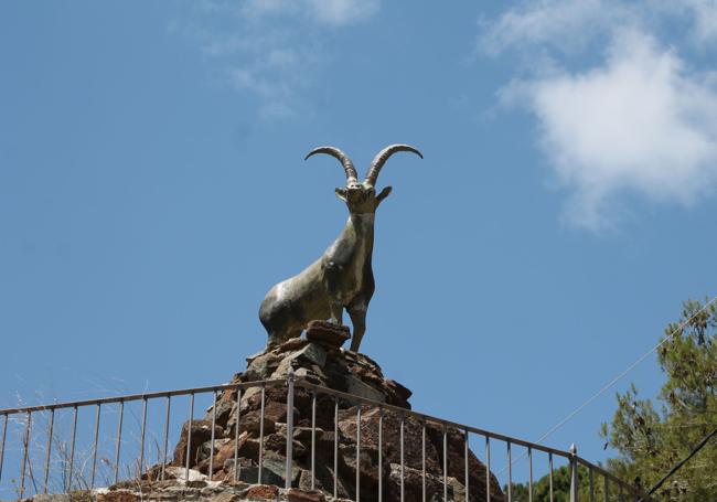
Nearby places of interest: Poza de la Virgen, salto de la Rejía, salto de Horcajuelos, the mountain goat statue, Rinconada district around Tolox castle, San Miguel church, the Cross of Padre Ventura, Horcajos river or Fuente Amargosa spa (normally open between May and October).
This route begins next to the well-known spa of Tolox, located very close to the village of the same name. Therefore, to get there you must first follow the signs to this village in the Sierra de las Nieves, that is to say, first on the A-357 and then on the A-354. Once at the entrance to the village, just follow the signs to the Fuente Amargosa spa. Next to this building, you can see the signposts for both this route and trails that start here.
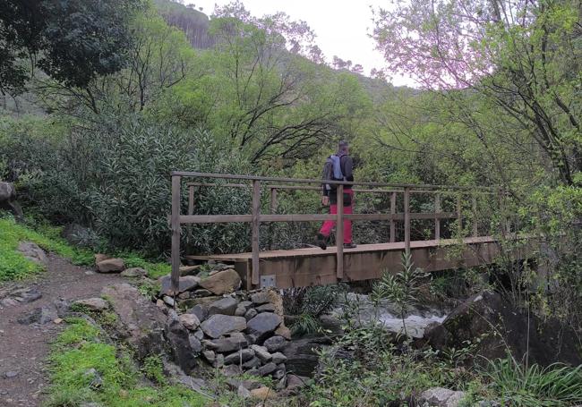
1The walk proposed on this occasion is only part of the 'cascadas' circular trail, which is just over ten kilometres long. In this case, a linear route is proposed that passes by two of the most important waterfalls on this itinerary, the Virgen and the Rejía waterfalls. The route starts next to the Fuente Amargosa spa and coincides in its first part with the Poza de la Virgen route. In recent years the route has been improved. In fact, since 2021 there have been new wooden bridges that allow you to cross the river comfortably for the first few metres. After crossing two footbridges, the path moves away from the Caballos river, which will be the main feature along the first stretch.
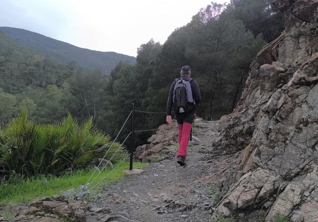
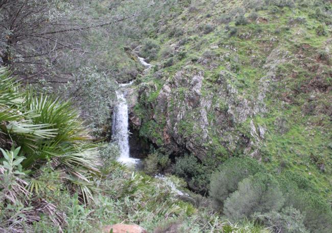
2The Caballos river is on the left on this first stretch of the ascent. You can see its course perfectly, as well as the inflow of water from different tributaries between autumn and spring, provided the rainfall has been good during those months. After an uphill section, there is a downhill section that joins the Caballos river and the fountain of the same name. Here you will have to ford the river. If the river is swollen due to recent rains, stepping through the rocks can be quite complicated. It may be time to turn back if you are not well-equipped. You can try to cross barefoot so as not to get your footwear wet (if not waterproof). In any case, once you have crossed this ford, you should bear in mind that you will have to cross it at least three more times to reach the pool of the Virgen.
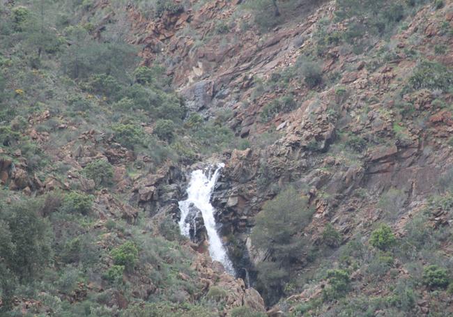
3After crossing the Caballos river three more times, the path goes uphill again, with the riverbed on the left. This avoids passing through private land used as orchards and other crops. Shortly afterwards, you will have to descend again to cross the river for the fourth time. Here you will have to look for a signpost that is fundamental to this route. It points out both the path to take to go to the Virgen pool and also the one that goes up to La Rejía. It is best to take the path to the Virgen first, return to this crossroads and continue on to the Rejía.
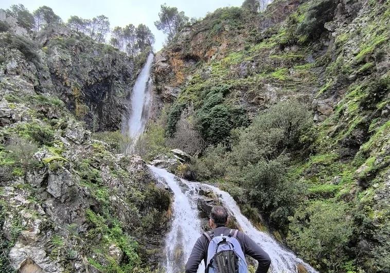
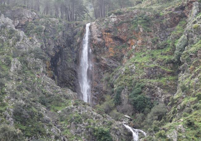
4Once you have seen the pool and waterfall known as the Poza de la Virgen and returned to the place where the walk up to the Rejía begins, the most physically demanding part of the trail begins. There are some steep sections, but the views of the Poza de la Virgen itself and other waterfalls first, and then later the Rejía waterfall (from a distance), reward the effort. After a little over a kilometre and a half of walking up an ascending path that gives some relief by zigzagging, you reach the viewpoint from where you have an excellent view of the Rejía waterfall, which, with a drop of over 50 metres, is considered to be the highest in Malaga province.
5The route goes as far as the Rejía waterfall itself. There you can decide whether to return along the same path or to follow this route in its entirety and continue on this circular route. In this case, you will continue towards the Horjacuelos waterfall, which you will have seen before reaching the Rejía (it is opposite). Then there is a stretch of mountainous territory where you will cross a dense pine forest and an ascending section, to then begin to descend along a narrow path to the Fuente Amargosa spa. If sticking to the linear route you will have to follow the same itinerary used on the way up, although you can skip the exit at the Poza de la Virgen if you covered that on the trail before.
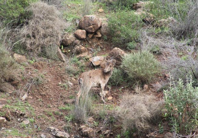
Along this route you can see orchards full of citrus trees, eucalyptus, gorse, ash, fan palms, ferns, pines and riverside vegetation. The botanical landscape along the trail is therefore very varied. In addition, there are some rarities like the Spanish fir ('pinsapo') in one riverside area. Although this tree species is abundant in this natural area, it is not so abundant to see it next to the bed of a stream that flows at an altitude of some 400 metres above sea level. As far as fauna are concerned, it is possible to see some birds of prey in flight and spot the presence of some mammals like wild boar or foxes. It will be much easier to spot the ibex, the queen of the Sierra de las Nieves, if you proceed with a certain amount of stealth. Among the reptile groups, watch out for the snub-nosed viper, which can be seen in spring and summer. Some fish can be spotted in the river, especially chub. There are also some amphibians, especially different species of frog.
Publicidad
Publicidad
Publicidad
Publicidad
Esta funcionalidad es exclusiva para registrados.
Reporta un error en esta noticia

Debido a un error no hemos podido dar de alta tu suscripción.
Por favor, ponte en contacto con Atención al Cliente.
¡Bienvenido a SURINENGLISH!
Tu suscripción con Google se ha realizado correctamente, pero ya tenías otra suscripción activa en SURINENGLISH.
Déjanos tus datos y nos pondremos en contacto contigo para analizar tu caso
¡Tu suscripción con Google se ha realizado correctamente!
La compra se ha asociado al siguiente email

Comentar es una ventaja exclusiva para registrados
¿Ya eres registrado?
Inicia sesiónNecesitas ser suscriptor para poder votar.