Hiking in Malaga
Sections
Highlight
This circular route runs through the easternmost part of the Sierra de Mijas mountains and passes through the Jabalcuza peak in Alhaurín de la Torre, Palomas peak in Churriana and the Cañada del Lobo in Torremolinos.
Area: Valle del Guadalhorce, Malaga and Costa del Sol
Municipalities: Alhaurín de la Torre, Malaga and Torremolinos
Difficulty level: Medium. Although the first part of the route, up to Jabalcuza, can be demanding, the rest is mainly flat. In the last few metres you descend along the same route you climbed at the beginning.
Type of route: Circular
Approximate duration: 3 hours and 45 minutes
Length: 11.9 kilometres.
Minimum altitude: 210 metres
Maximum altitude: 679 metres
Nearby places of interest: Puerto Canuto, Jabalcuza natural monument, Palomas peak, Blanquillo pass, Lobo and Madroño viewpoints and Calamorro peak.
The starting point for this route is in the upper part of the Los Manantiales residential area in Alhaurín de la Torre at the end of the Camino de las Viñas. You can get there by car through the Los Manantiales area. It is advisable to leave your car parked further down Calle Camino de las Viñas.
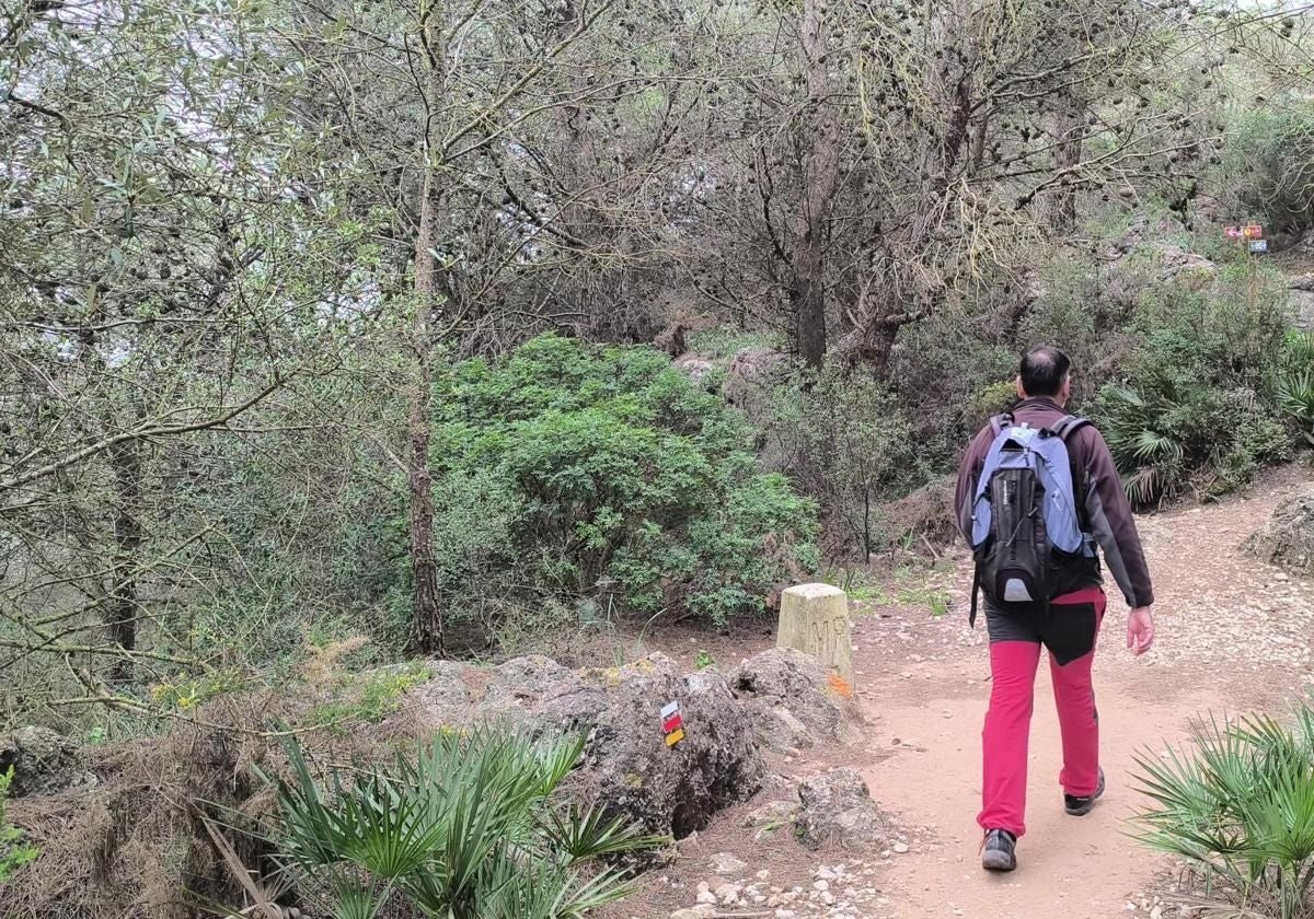
1This route is approved by the Andalusian mountaineering federation (SL-A50), also coincides for a good part of the route with stage 34 of the Gran Senda de Málaga between Benalmádena and Alhaurín de la Torre. The route climbs two emblematic peaks of this mountain range, Jabalcuza and Palomas. In the first few metres, the path runs along the Zambrano stream, which is usually dry or carries little water. After passing through an olive grove, the path enters among stone and Aleppo pines before it begins to climb. On several occasions the path crosses the Zambrano stream. After the first kilometre the ascent becomes slightly steeper, the path a little narrower and the vegetation a little more lush.
2After almost two kilometres of climbing, you reach Puerto Canuto where you will find a crossroads. The one on the left goes towards the summit of Jabalcuza, while the one on the right heads towards the summit of Palomas (Malaga) and the one in the centre faces a descent towards Torremolinos. You should first take the one that goes towards Jabalcuza. Once you have taken the turning to the left, the first few metres of the climb are a little less steep. After that, you are almost 600 metres above sea level. There is only a little more than 70 metres of height difference left to overcome (Jabalcuza is 679 metres above sea level).
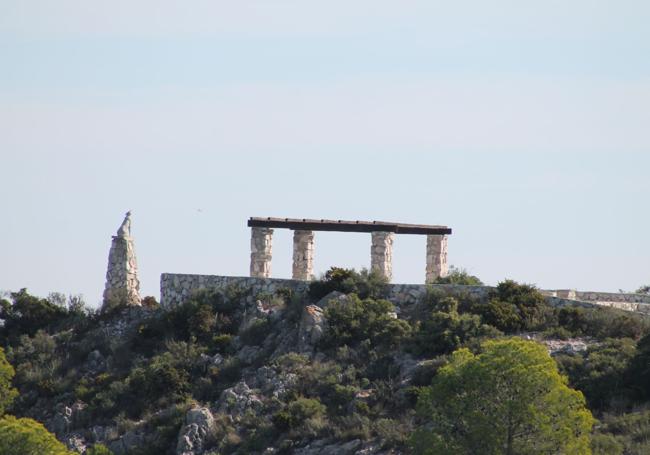
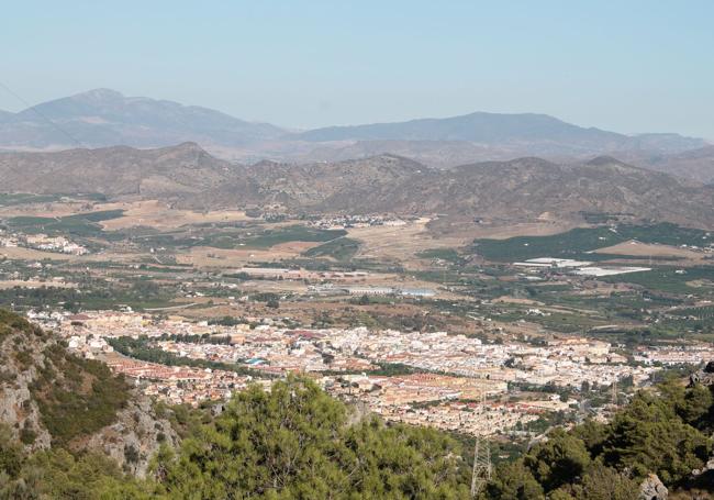
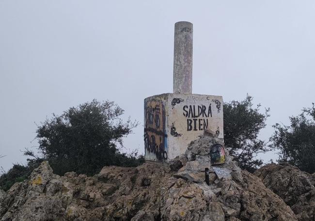
3The last stretch towards the viewpoint and the summit of Jabalcuza is the easiest part as not only does it not climb very steeply and even has a slight descent. In just over five minutes you reach the end of the climb, where you will see a panel indicating the panoramic views as well as information on the ecosystem of this mountain range. On clear days, there are excellent views of the bay of Malaga, the Guadalhorce Valley, the Montes de Málaga, the coastline from Torremolinos to Fuengirola and the main peaks of the Sierra de Mijas. From there you can also see the peaks of the Sierra Nevada and Sierra Tejeda among others. After enjoying the views, you will have to return a few metres along the same steps, but shortly afterwards you will have to take a narrow path that turns southwest to head towards the Palomas peak (this avoids going all the way down to Puerto Canuto). This path is not too steep except for the last few metres.
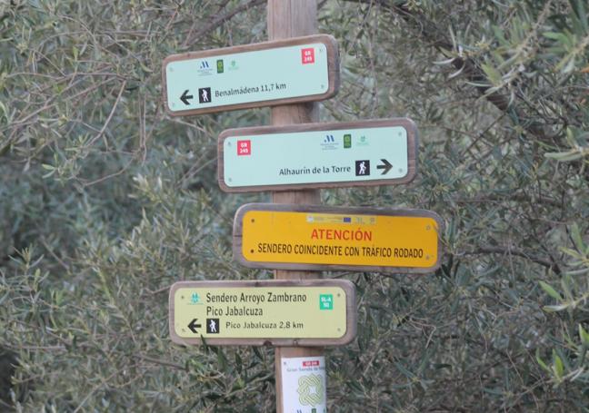
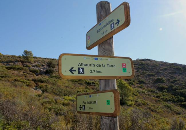
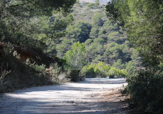
4From Palomas peak, you must now take a path that heads towards Puerto Canuto, and then take the signposted path of the Gran Senda de Málaga that links this enclave with Benalmádena. After about four kilometres, along a relatively easy path without many slopes, you pass through Puerto Blanquillo and then arrive at the area known as Cañada del Lobo. After passing the hostel and the refuge, you take a track to the left that turns towards the emblematic El Lobo viewpoint.
5After enjoying the views from the Lobo viewpoint, you can go to another very close one, the Madroño viewpoint. Afterwards, it is time to return along the same path to Puerto Canuto. Finally, from this crossroads, you will descend to the starting point along the same path along which you started the route. Special attention should be paid to loose stones and wet areas on the path, which can cause falls.
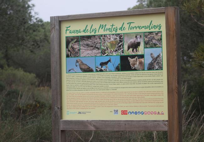
The ecosystem of the easternmost part of the Sierra de Mijas offers an abundance of both animal and plant species. In addition to the pines and olive trees, you can find very Mediterranean plants and shrubs such as palmetto, blackberry, thyme, rosemary and ivy. As far as animals are concerned, this is a refuge for certain large mammals, such as the mountain goat (particularly abundant), wild boar and foxes. Hedgehogs, weasels, genets and badgers have also been sighted. As for birds, golden eagles, peregrine falcons and kestrels sometimes fly over the peak. When the sun sets, owls, owlets and owls become the protagonists.
Publicidad
Publicidad
Publicidad
Publicidad
Esta funcionalidad es exclusiva para registrados.
Reporta un error en esta noticia

Debido a un error no hemos podido dar de alta tu suscripción.
Por favor, ponte en contacto con Atención al Cliente.
¡Bienvenido a SURINENGLISH!
Tu suscripción con Google se ha realizado correctamente, pero ya tenías otra suscripción activa en SURINENGLISH.
Déjanos tus datos y nos pondremos en contacto contigo para analizar tu caso
¡Tu suscripción con Google se ha realizado correctamente!
La compra se ha asociado al siguiente email

Comentar es una ventaja exclusiva para registrados
¿Ya eres registrado?
Inicia sesiónNecesitas ser suscriptor para poder votar.