A circular hike with idyllic coves, watchtowers and panoramic views of the Mediterranean Sea on the eastern Costa del Sol
This route passes by the beaches of Cañuelo, La Doncella and Cantarriján and next to old buildings that once controlled the coast, although there are stretches that are not suitable for people who are afraid of heights

This circular hike takes in the Maro cliffs and Cañuelo and Cantarriján and La Doncella beaches, as well as other landmarks of interest such as old watchtowers that once served to watch over this stretch of the eastern Costa del Sol.
-
Route data
Malaga province area: Axarquía
Municipality: Nerja
Difficulty level: Medium-high. Although the route is not excessively long or steep, much of the way is along narrow paths, which, although intuitive, are not always properly signposted (only blue markings in some sections). Furthermore, in the area around La Doncella there are stretches that are not suitable for people who are afraid of heights. It is not a route that is recommended for children or older people or those who are not used to hiking.
Type of route: Circular.
Approximate duration: 2 hours and 45 minutes
Length: 6.7 kilometres.
Minimum height: 1 metre
Maximum height: 157 metres.
Nearby places of interest: Towers of la Caleta, del Pino and Maro, natural site of the Cliffs of Maro, Cañuelo, La Doncella and Cantarriján beaches, San Judas Tadeo chapel, Balcón de Europa, Maro village, Museum of Nerja, El Águila aqueduct and Nerja Cave.
-
How to get to the starting point
The starting point of this route is next to the old N-340, the coastal road that provides direct access to the natural site of the Maro-Cerro Gordo cliffs. The path leads down to the beach next to the car park. To get there, take the N-340 on the perimeter of the Maro cliffs. Between kilometres 302 and 303, there is a roundabout where you must turn off towards Cañuelo beach. The vehicle must be left in the areas provided for this purpose. The starting point is next to a stop for the shuttle that goes up and down to the beach.
-
Route description
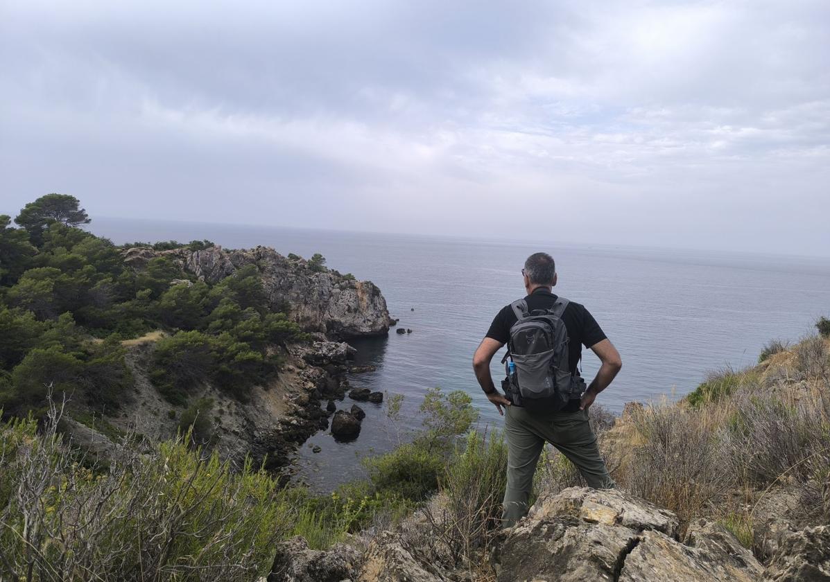
1From the car park, go along the path where access by car is restricted. Just ten metres further on, this lane forks off onto a path on the right. This is indicated by an approved sign and also has a sign describing the path itself. Along this path you start to descend slightly through Aleppo pines and various types of bushes until it connects, some 400 metres further on, with the asphalted track, on which only authorised vehicles can travel. Once connected with this road, the path continues descending towards the Cañuelo beach. From there, you can enjoy beautiful panoramic views of this cove, but also of a good part of the natural landscape of the Maro-Cerro Gordo cliffs.
-kxwH-U200307812870YJI-650x455@Diario%20Sur.jpg)
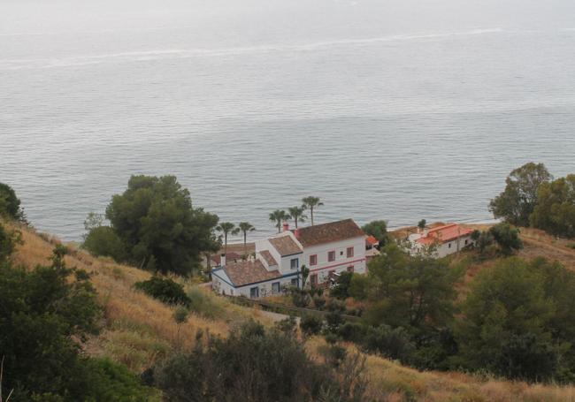
2After a kilometre of descent, you can see El Delfín and El Velero, houses that were once Guardia Civil barracks. You can go down past them to reach El Cañuelo beach, but you can also use a path that goes off to the left and goes down to come out right next to the Las Piedras beach bar, also on the same beach. From there, walk eastwards until you reach the end of this cove. Just there on the left is a narrow, ascending path that leads to La Doncella cove. Care must be taken on this path and it is not suitable for small children, older people or those who are afraid of heights.
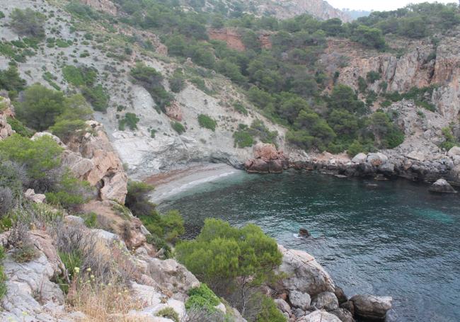
3After a couple of hundred metres of ascent, the idyllic La Doncella cove appears and a narrow path leads down to some rocks that give access to this hidden cove. In recent years, algae have grown both on the sandy beach and under its crystal-clear waters. After seeing the cove, it is time to return along the same path both by the old barracks and a few metres uphill, where you take a narrow, slightly ascending path that heads eastwards, so that La Doncella is below on the right. You then go along the edge of a cut to continue towards the east, which leads you to a dense area with a leafy pine grove.
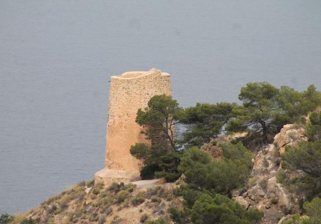
4From this thick forest the path can continue eastwards, but it is advisable to first make a round trip southwards to see the 16th century Caleta tower, one of the watchtowers that mark out this natural spot. The route is intuitive and relatively easy, allowing you to reach the watchtower itself and even, a little earlier, to get a better view of La Doncella on the right. Afterwards, you return to the point where you made the incursion to continue eastwards. You will alternate stretches in the sun with others through a forest until you reach Cantarriján naturist beach, which is in Granada province. You will see this famous cove at your feet, but to get there you will have to follow a descending path towards the north, which will take you to the Cantarriján dry riverbed. Once there, all that remains is to walk to the right for about three hundred metres to reach the beach. Afterwards, you will have to return along the same dry riverbed to start the last stretch.
-kxwH-U200307812870YJI-650x455@Diario%20Sur.jpg)
5You will have to climb for approximately one kilometre until you see a narrow path on the left that climbs up and gradually moves away from the stream. Then you will pass a shack and shortly afterwards you will see the motorway viaduct over the Cantarriján stream. When you see the viaduct, look to the left to see the hut that serves as a halt for the shuttle that goes up and down to Cañuelo beach, i.e. the starting point. You will have to get there along a path that goes uphill, but with relatively gentle slopes thanks to a route full of bends. However, in the last ten metres you will have to tackle a fairly steep section, where you will have to be careful not to slip or lose your balance. This will take you back to the starting point of this circular route.
Flora and fauna
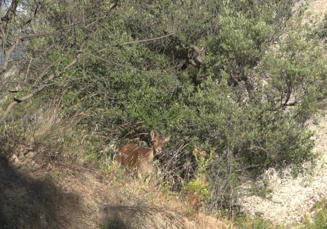
In this protected area, you can see palmetto, matagallos, maritime rosemary, thyme, lavender, myrtle, myrtle and mastic, among other plants. In addition, along the route, you will be able to see different groves of trees, although the most abundant are the stone pines. At certain times of the day you may see mountain goats, which sometimes go down to the beach at dusk. Other mammals that live in this area include wild boar, foxes and genets. As for the birds, there is even more diversity, as you can see everything from a peregrine falcon to a yellow-legged gull or a robin. To all this must be added the biological diversity under the sea, which is one of the reasons why this stretch of Andalusian coastline is protected as a natural area.

Comentar es una ventaja exclusiva para registrados
¿Ya eres registrado?
Inicia sesiónNecesitas ser suscriptor para poder votar.