
Sections
Highlight

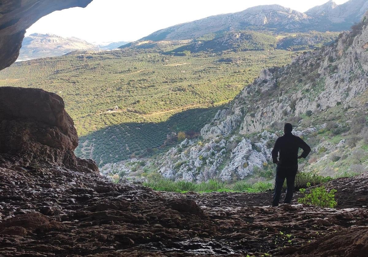
A very popular linear path, but not officially approved, which allows you to climb up to the Malnombre cave, an emblem of Villanueva del Rosario.
Region: Sierra Norte de Málaga
Municipality: Villanueva del Rosario
Difficulty level: Medium. Although it only has demanding sections in the second half of the route, as it is not certified, it should be considered as a route that is only suitable for people for regular hikers and mountaineers. The route has no milestones or markers, but it is easy to follow. It is advisable to take a map or mobile phone app.
Type of route: Linear
Approximate duration: 1 hour 15 minutes (one way)
Length: 3 kilometres (one way).
Minimum altitude: 690 metres
Maximum altitude: 941 metres
Nearby places of interest: Nuestra Señora del Rosario chapel, the Chamizo peak, Alto Hondonero viewpoint, the 'Derrumbaero', Hondonero gorge, source of the river Cerezo, Hondonero via ferrata, Vieja, de la Zarza and Hondonero springs and Pilas del Señorito.
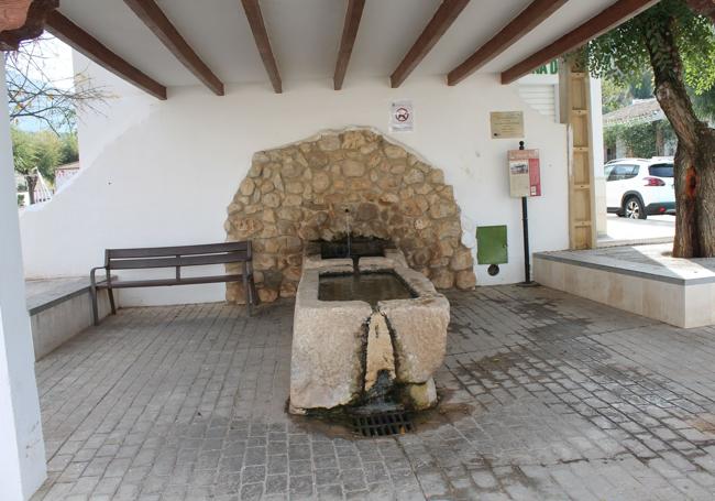
To begin this route, head for Villanueva del Rosario . The best starting point is the tourist office, located next to the Fuente Vieja (it is usually easy to park nearby). From there you will have to find the sign for the Fuentes de Hondoneros footpath. Follow an asphalted track uphill for just over a kilometre until you reach the Nuestra Señora del Rosario chapel. This could also be the starting point for those who do not have much time or who prefer to shorten the route and make it easier. In this case, it is possible to reach it by car, unless expressly prohibited by the municipal authorities. It is also necessary to make sure that it is possible to park the vehicle on the esplanade next to the chapel.
1From the tourist office you should look for the sign indicating the Fuentes de Hondoneros route along the Nacimiento path, although you could also go in parallel along the La Loma path. Both paths will lead to the Nuestra Señora del Rosario chapel, which is the first important landmark on this route. On certain days of the year there may be possible access and parking restrictions.
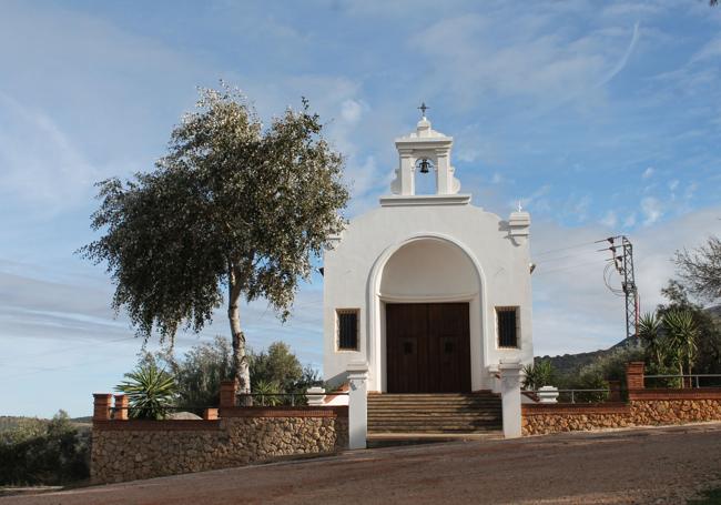
2From the chapel we will have to go down a descending path towards the second important landmark on this route, the source of the River Chorro, where, rainfall permitting, the current of the Cerezo stream, one of the many tributaries of the Guadalhorce river can be strong. It is necessary to cross a riverbed by means of a bridge that has been built for this purpose. Just after this, turn off to the right along the course of the river until you reach an olive grove. This last stretch, if it has rained a lot, will be complicated. Be careful not to get your shoes wet.
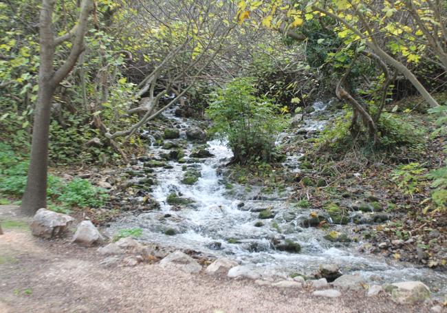
3After reaching the olive grove, take a narrow path on the left which, after a couple of hundred metres, leads to a gate which must be closed. You can open it, but then leave it closed as indicated on a sign. The route then continues along a narrow, leafy path to the Chorro Negro spring, a spectacular natural passage where the geological formations are surprising. After another two hundred metres you will reach another gate, but this time you will not have to open it, as you have to take an ascending path just to the left. From here the most demanding part of the route begins.
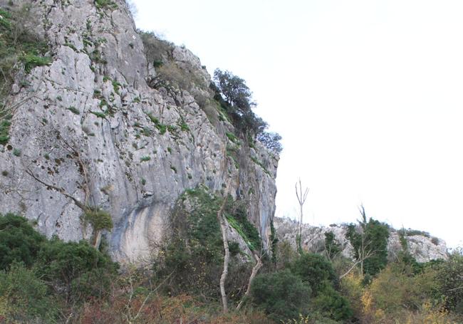
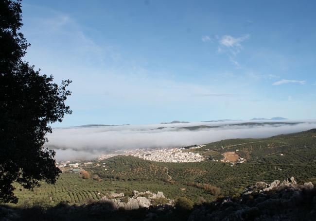
4The path runs between two limestone rocky outcrops, along a path that is not signposted, but which remains clear. The zigzagging route eases the ascent, although there are some demanding stretches. As you gain altitude, you will also be able to enjoy wide panoramic views, such as the one overlooking the village of Villanueva del Rosario and a large part of the mountain range. A little further on you will be able to clearly see the impressive Malnombre cave.
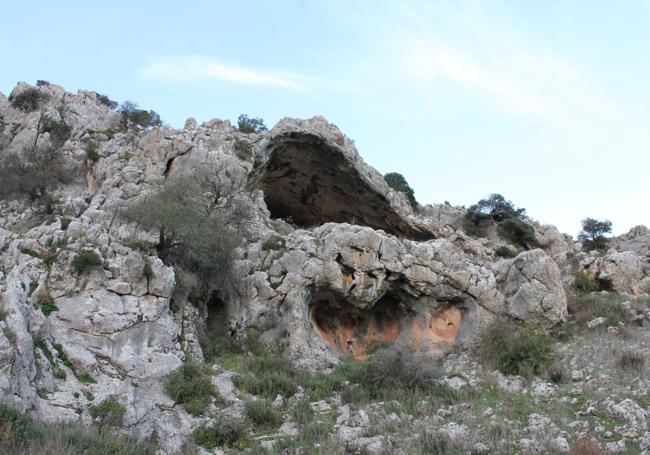
5Leave the path through a small gate and then take a path to the right that goes along a fence. Along this path, which is still narrow, you start the ascent to the Malnombre cave. First you will follow a flat stretch, but shortly afterwards you will begin the final ascent to reach this cave, from where you have a spectacular view. It is a historic cave, as it has served as a refuge for humans since the first settlers (officially, it is known from findings of cave paintings) until only a few decades ago. Today it also serves as a shelter for livestock in the area. After enjoying the panoramic views from the cave and the interior of the cave itself, it is time to return along the same path. However, before the source of the Chorro, you can choose a path that runs parallel to the stream. This will first be on the right, but then you will have to cross it. This way, among olive trees, you will still reach the tourist office, but without passing the chapel.
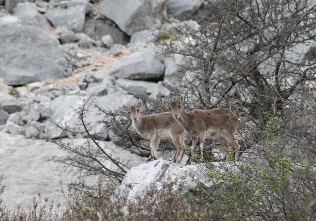
This route offers a wonderful variety of wildlife. It starts next to olive groves and enters a lush Mediterranean scrub forest. There are also abundant holm oaks and kermes oaks among other plant species of interest. You can also see numerous specimens of hawthorn trees in the highest area. You may be able to spot a cork oak spider and mountain goats, which can be seen in the highest part of the sierra. You might be lucky enough to see birds of prey such as the peregrine falcon and the golden eagle. Blackbirds, partridges, warblers and other smaller birds can also be seen along the way. In the steepest area, the red-billed chough can often be seen flying.
Publicidad
Publicidad
Publicidad
Publicidad
Esta funcionalidad es exclusiva para suscriptores.
Reporta un error en esta noticia
Comentar es una ventaja exclusiva para registrados
¿Ya eres registrado?
Inicia sesiónNecesitas ser suscriptor para poder votar.